Shaik Mohammad Irfan
Senior GIS Analyst & Subject Matter Expert
Architecting Digital Twins for Urban Resilience.
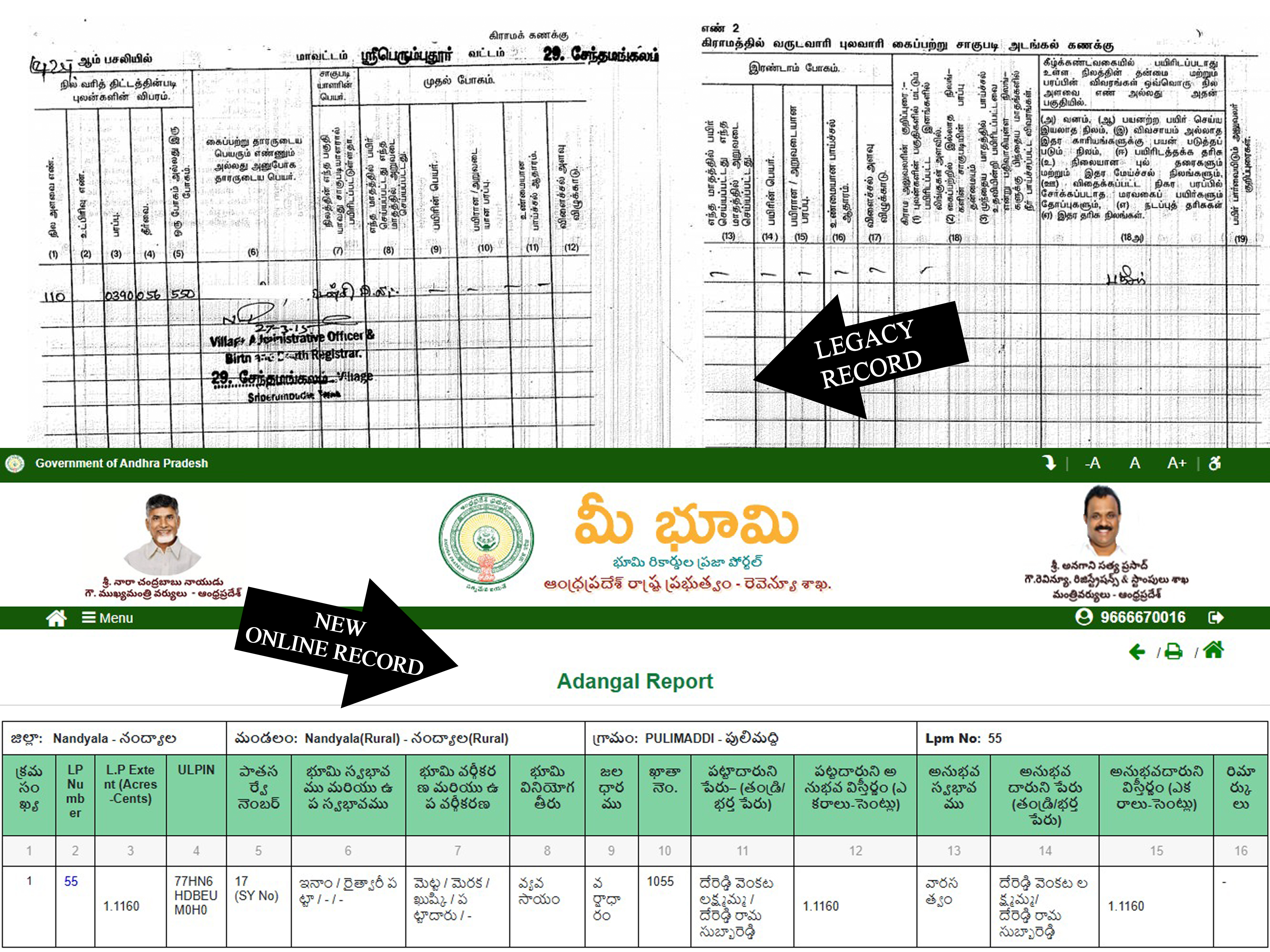
8+ years of expertise in high-fidelity geospatial operations. Leading the transition from legacy 2D records to centimeter-accurate digital twins for urban governance and national infrastructure.
Program Operations Hub
TCUR / HMDA Scale Ready
Volume
200k+
Valid Parcels
Precision
6-Dec
Decimal Standard
Agile Impact
+20%
Throughput Gain
Leadership
100+
Mentored